
Geo Oceans has recently conducted a benthic habitat mapping survey for a defence client in northern Australia.
Benthic habitat mapping survey completed
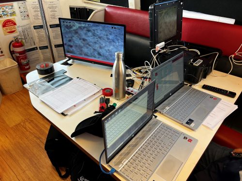
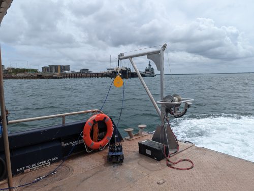
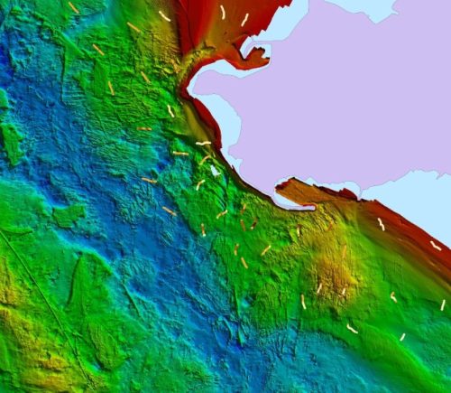
The project included deployment of Geo Oceans GO VisionsTM towed underwater camera systems and custom software to classify benthic habitat communities based on a hierarchical classification system aligned with Catami. We operated high definition, underwater video and DSLR still cameras, remotely controlled and interfaced with our GO VisionTM software combining GPS encoded data into a database in real time in order to produce fine scale mapping data across the survey areas. Around 70 transects were performed which recorded over 50,000 data points throughout the survey, each point comprising of an attribute table with over 20 variables. Our GO Visions software enables post analysis of this data in Arc GIS giving the potential for millions of data variables with which to make modelling decisions to support environmental management.
Our GO VisionTM software has been used as one of the globally, leading Benthic Habitat mapping software packages for over 12 years now and has recorded millions of data points supporting critical environmental management decisions across many large and small coastal construction, resources, conservation and decommissioning projects for industry governments and not-for-profit sectors.