
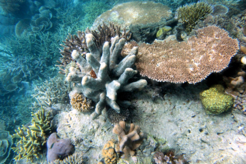
Geo Oceans’ marine scientists mobilised a towed camera (drop camera) and Mini ROV system with USBL spatial positioning to the north east coast of Australia to capture geo-referenced still images and HD video over several coral patches.
The images were analysed for biota (e.g. coral, seagrass macroalgae) percent cover and substrate profile and type using the GO Visions™ software. The data were displayed in GIS software in real-time as point data overlaid on multibeam sonar data, and the outputs were used to guide site selection and survey design during the campaign.